
Pennsylvania's State Forests offer thousands of miles and hundreds of acres of designated snowmobile areas for exploration. Opportunities range from scenic trails through the woods, to straightaway runs on roadways, to large, open spaces. Trails open the day after the last day of Pennsylvania's regular or extended rifle deer season and close April 1, or earlier as determined by the district forester.
Click one of the regions on the map below to see trail listings, maps and snow conditions.
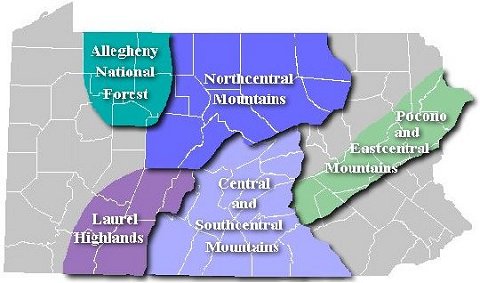
Select a region from the map above
or from the list below
to view trail maps, trail conditions and joint-use roads status.
| Region: | |
|
|
|
| Allegheny National Forest | Warren, Forest, McKean |
| Northcentral Mountains | Cameron, Elk, Clearfield, Clinton, Lycoming, Potter, Sullivan, Tioga |
| Laurel Highlands | Western Somerset, Westmoreland |
| Central and Southcentral Mountains | Adams, Bedford, Fulton, Franklin, Huntingdon, Perry, Snyder, Northeastern Somerset, Union |
| Pocono and Eastcentral Mountains | Dauphin, Lackawanna, Monroe, Pike |